September 22, 2024 · 4 min read
Blue Ridge Parkway, North Carolina and Virginia
By the Credence Charter Bus team

The Blue Ridge Parkway runs 469 miles from Shenandoah National Park in Virginia to the Great Smoky Mountains in North Carolina, with a 45 mile-an-hour limit, no commercial development, and an overlook every few miles. It is the most visited unit of the National Park System most years. Running a charter bus on the Blue Ridge Parkway is entirely possible and it requires two things to be settled before anything else.
Permits and tunnels: settle these first
Commercial traffic on the Parkway is restricted, and a commercial tour operating on it needs the appropriate National Park Service authorisation. A legitimate charter operator will hold it or know how to obtain it. Ask the question early rather than assuming.
The second constraint is physical. The Parkway has twenty-six tunnels, all but one of them in North Carolina, and clearances at the tunnel edges are low — several are marked well under thirteen feet at the sides even where the center is higher. The North Carolina section south of Asheville is the most restricted, and the northern Virginia half has effectively one tunnel and is far more forgiving for a large vehicle.
The practical upshot: a full-size coach is comfortable on the Virginia section, and the southern North Carolina stretch needs a smaller vehicle and a route checked tunnel by tunnel.
Do not attempt the whole thing
At 45 miles an hour, 469 miles is more than ten hours of driving before a single stop. Groups that set out to drive the Parkway end to end in two days see it through a window. Pick a section of eighty to a hundred and twenty miles and give it a full day.
- Virginia, milepost 0–120: the gentlest terrain and the easiest for a large vehicle. Humpback Rocks, the Peaks of Otter and Mabry Mill, which is the single most photographed spot on the whole road.
- Virginia into North Carolina, milepost 175–290: Blue Ridge Music Center, Doughton Park and the approach to Boone and Blowing Rock.
- North Carolina, milepost 290–380: Linn Cove Viaduct curling around Grandfather Mountain, Linville Falls, and the descent toward Asheville. The most dramatic section and the most tunnel-constrained.
- North Carolina, milepost 380–469: Asheville, Mount Mitchell, the highest point east of the Mississippi, and the southern terminus at Cherokee.
Which charter bus suits the Parkway
- Twenty to thirty-two: a mini bus is the vehicle that can run the whole road, including the southern tunnels, and fits the smaller overlooks.
- Forty to fifty-six: a full-size charter bus is comfortable on the Virginia section and for the approach drives, with an on-board restroom that matters on a road with few facilities.
- Ten to fourteen: a sprinter van reaches every pull-off and suits a photography group.
Fuel is worth planning. There are no filling stations on the Parkway itself, and a driver who has not planned exits accordingly will be leaving the road at an inconvenient moment.
Getting there
Roanoke sits right on the Parkway and is the best base for the Virginia section. Asheville is the equivalent in North Carolina, with Boone and Blowing Rock covering the middle and Cherokee at the southern end. Waynesboro marks milepost zero where Skyline Drive ends.
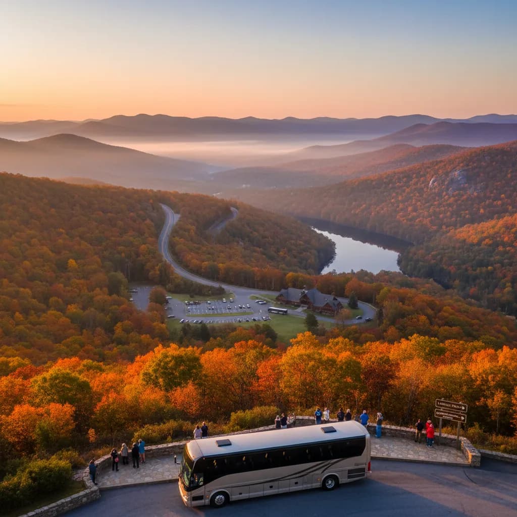
Groups searching for charter bus rental near me for an October Parkway trip should book by early summer. Peak foliage on the Blue Ridge is the highest-demand two weeks of the year for coaches across the whole Southeast, and sections of the road can close for weather or maintenance at short notice.
What the road actually is
The Parkway was begun in 1935 as a Depression-era public works project and was not finished until 1987, when the Linn Cove Viaduct finally closed the last gap around Grandfather Mountain. That viaduct is worth understanding before you drive it: it was built in segments from above, piece by piece, specifically so that construction equipment would never touch the mountainside below it.
The whole road was designed to be looked at rather than traveled through. There are no billboards, no trucks, no traffic lights and no commercial frontage along 469 miles, which is why it still feels like the 1930s idea of a scenic drive. It also explains the restrictions — the absence of commercial traffic is a design decision, not an oversight.
For a group, that changes what the day is. On most itineraries the drive is the cost of reaching the attraction. Here the drive is the attraction, and the stops are punctuation.
When to go
October is the reason most people come, with color moving down the ridges through the month. June brings rhododendron and mountain laurel in bloom and far fewer people. Summer is green, cool at elevation and hazy. Large sections close through winter for snow and ice, often for weeks at a time, so a December itinerary needs constant checking and a fallback.
Booking the trip
Tell us which section you want and your headcount, and we will confirm vehicle clearance against the tunnels on that stretch before quoting. Our event transportation team plans multi-day Parkway itineraries around driving hours rather than mileage, which on a 45 mile-an-hour road is the only number that means anything.
Request an all-in quote and you will usually have an itemized price back the same day, driver, fuel, tolls and taxes included.